

ShapingSEQ 2023
ShapingSEQ 2023 is the Queensland Government’s long-term vision for added growth in our changing South East Queensland region. It’s a plan to ensure we can accommodate future population growth while sustainably enhancing our communities and maintaining the South East Queensland we love.
ShapingSEQ 2023 took effect on 15 December 2023, and amends ShapingSEQ 2017. ShapingSEQ 2023 is an initiative under Homes for Queenslanders.
View ShapingSEQ 2023
- ShapingSEQ 2023 (low resolution) (PDF, 13MB)
- ShapingSEQ 2023 (high resolution) (PDF, 307MB)
Why we need ShapingSEQ
South East Queensland is growing and changing. By 2046 our population is expected to be about six million. That’s an additional 2.2 million people requiring almost 900,000 new homes and almost one million new jobs.
The Federal Government’s National Housing Accord provides a target of 1.2 million new, well-located homes to be delivered across Australia over five years from mid-2024. In addition, the Federal Government’s National Planning Reform Blueprint requires state and local governments’ planning tools to reconsider zoning, land release and other planning reforms to unlock and assist the delivery of more housing.
The dwelling supply targets within ShapingSEQ 2023 provide for South East Queensland’s fair share of well-located homes to meet this national housing demand. The plan also responds to the National Planning Reform Blueprint by providing dwelling diversity and social housing and affordable housing sub-targets, and a new high amenity areas framework, that ensure planning processes do not stall the delivery of more well-located, affordable and diverse homes.
The 2022 Queensland Government Housing Summit set out a range of actions to address the housing needs of Queenslanders, including reviewing and refining ShapingSEQ 2017. This review is now complete and ShapingSEQ 2023 positions us to be ready for growth.
When done well, growth is an opportunity to expand and enhance our already great communities and support the different needs and lifestyles of all Queenslanders.
How South East Queensland is changing
While our population is growing, our household dynamic is also changing. Households in the region have become smaller and more diverse due to changing family structures, and people have different housing needs and preferences for certain types of housing at different stages of their lives. There is also greater demand for attached housing and smaller homes and an increase in single-person and couple-only households.
Region at a glance
-
Our population is growing, due largely to interstate migration1
-
People are living longer, healthier and independent lives2
-
Decrease of large families living under one roof, many people live alone3
- Today: Population 3.8m / 2046: Population 6m
- Today: 15% of Queenslanders aged 65+ (1 in 7) / 2046: 19% of Queenslanders aged 65+ (1 in 5)
- Couple without children households - Today: 404k / 2046: 589k people. Lone person households – Today: 344k / 2046: 596k
How to read ShapingSEQ 2023
-
The 10 regional priorities as the focus of the plan.
Read Chapter 2, Regional Priorities (
 877.0 KB)
 -
- Efficient land use
- Housing supply
- Housing diversity
- Social housing and affordable housing
- Growing rural towns and villages
Read Chapter 3, Part A Grow (
1.2 MB) -
- Regional Economic Clusters
- Regional Activity Centres Network
- Knowledge and technology precincts
- Major Enterprise and Industrial Areas and other industrial areas
- Tourism and events
- Special uses
- Rural prosperity
Read Chapter 3, Part A Prosper (
1001.2 KB) -
- An efficient and sustainable movement system
- Active transport
- Vibrant and connected regional activity centres
- Integrated infrastructure and land use planning
- Region-Shaping Infrastructure
- Movement and Place
Read Chapter 3, Part A Connect (
732.7 KB) -
- Respecting and embedding First Nations culture and knowledge in planning
- Biodiversity
- Koala conservation
- Regional landscapes
- Water sensitive communities
- Natural economic resources
- Climate change
- Resilience
Read Chapter 3, Part A Sustain (
1.3 MB) -
- Good design
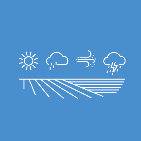
- Working with the weather
- South East Queensland’s local character
- Equitable communities
- Working with and enhancing natural systems
- Legible and connected streets and spaces
- Adaptation and change
- Placemaking
- Health and wellbeing through built environment
Read Chapter 3, Part A Live (
287.6 KB) -
ShapingSEQ 2023’s regional growth pattern
Regional Land Use Categories:
- Regional Landscape and Rural Production Area
- Urban Footprint
- Rural Living Area
Read Chapter 3, Part B The regional growth pattern (
427.7 KB) -
What’s planned for your local area
Read Chapter 3, Part C Sub-regional directions (
2.2 MB) -
How this plan will be implemented
Read Chapter 4, Implementation assurance (
1.1 MB) -
Find out more about SEQs two areas of regional interest
Read Chapter 5, Resource activity (
372.5 KB)
About ShapingSEQ 2023
ShapingSEQ 2023 is the South East Queensland Regional Plan and encompasses the 12 local government areas of Brisbane, Gold Coast, Ipswich, Lockyer Valley, Logan, Moreton Bay, Noosa, Redland, Scenic Rim, Somerset, Sunshine Coast, and Toowoomba (urban extent).
ShapingSEQ 2023 sets a long-term vision for the growth of our region, as well as a series of outcomes and actions to achieve this vision. Through its revised approach to implementing the plan, ShapingSEQ 2023 has a strong focus on ensuring that these outcomes and actions result in delivery on the ground. To focus this implementation, the plan identifies ten regional priorities which underpin all priority actions. The regional priorities are:
| A sustainable growth patternEncouraging growth within existing urban areas that have good access to employment, services, natural areas and amenities. |
More homes, faster – supply, diversity and affordabilityUnlocking more homes in well-located areas, providing greater housing choice typology and tenure to protect liveability and create fairer housing opportunities. | |
 | More social and affordable homesSetting a combined social housing and affordable housing target to deliver housing for vulnerable people, people on low and moderate incomes, and essential workers needed to maintain our communities and lifestyles. |
| Well-designed communitiesConsidering the lifestyle needs of residents, including public and active transport, communal green space, and climate responsive design. |
 | Integrating land use and infrastructurePlanning for and delivering infrastructure in a timely and coordinated manner as and when its needed to support both residential and employment lands. |
| New economic opportunities and jobsSupporting a range of different types of jobs and economic opportunities through Regional Economic Clusters (RECs), Regional Activity Centres Network (RACN) and Major Enterprise and Industry Areas (MEIAs). |
| A sufficient pipeline of industrial landSupplying sufficient industrial land to service the growing population and support innovations in manufacturing, energy and waste management, including supporting the resource recovery and recycling task. |
| Incorporating Aboriginal and Torres Strait Islander knowledge, culture, traditions and aspirationsProviding a partnership approach for advice and shared decision-making for South East Queensland with Aboriginal and Torres Strait Islander peoples. |
| Regional approach to natural hazardsAdapting and building resilience to increase the capacity for South East Queensland to cope with future natural hazard events and disruptions. |
| Better biodiversity outcomes for growth areasProviding clear guidance on areas to be protected from development, areas that may be prioritised for development and areas where development can proceed if it will appropriately protect biodiversity values. |


Want to learn more about ShapingSEQ 2023
-
ShapingSEQ themes
Find out more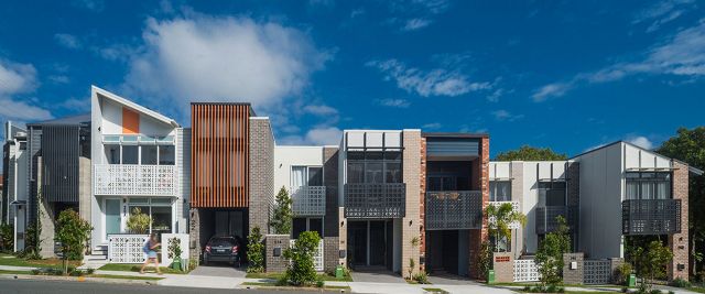
-
Delivering ShapingSEQ
Find out more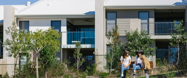
-
Regional Land Use Categories
Find out more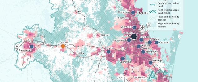
Want to find out more about ShapingSEQ?
-
Supporting documentation
Find out more
-
Frequently asked questions
Find out more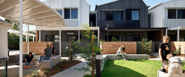
-
SEQIS
Find out more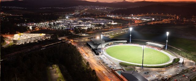
Last updated: 04 Apr 2024